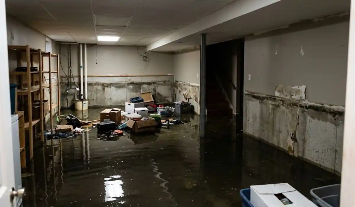
When Sandy came ashore on October 29, 2012, the Town of Islip ordered mandatory evacuations for Category 1 storm surge zones, mobile home parks, and Fire Island. Streets and parcels south of Montauk Highway were named specifically in that order, and town officials pushed residents to leave in daylight, well ahead of high tide that Sunday night. Most people obeyed. Long Island lost no lives to the storm along its south shore, but the property damage in low-lying communities like Bay Shore, Brightwaters, and East Islip was severe: bay water pushed over bulkheads and into streets, and it did not stop at the curb.
That distinction matters more than it sounds like it should. A lot of East Islip basement flooding during Sandy was not rainfall finding its way in through a foundation crack. It was Great South Bay itself, forced inland by wind and surge, moving through storm drains and low points in the street grid until it reached the lowest part of every house in its path. Basements below the surge line took water directly. Basements just outside the mapped zone often still flooded, because groundwater across the area was already elevated before the surge arrived.
Why The Water Table Made It Worse
South shore Islip sits on ground where the water table runs close to the surface even in ordinary weather. When storm surge pushes bay water inland, it does not just sit on top of the ground. It saturates soil that is often already damp, which raises the water table further and keeps basements wet long after the visible flooding on the street has receded. This is part of why some East Islip homeowners reported water re-entering a basement days after Sandy passed, even after an initial pump-out. The ground itself was still releasing water into foundations.
It is also why waterproofing advice built for inland Suffolk County towns does not fully apply here. A French drain and a single sump pump handle rainfall runoff well. They are a much thinner defense against a saturated water table pushing up from below during and after a surge event.
What Actually Held Up, And What Didn't
Looking at which East Islip basements came through Sandy with less damage, a few patterns show up consistently. Homes with a sump pump on a battery backup, rather than relying solely on grid power, kept pumping through the outages that hit most of the south shore for days, avoiding the kind of basement mold removal call that follows a prolonged flood. Homes with a perimeter drain system tied into that pump handled the groundwater rise better than homes with just a sump pit and no drainage network feeding it. And homes where the sump discharge line ran well clear of the foundation, rather than dumping water a few feet from the house, did not see the same water simply cycle back in.
What did not hold up: older sump systems with no backup power, a single point of failure that took itself offline the moment the block lost electricity, which was most of the block for days after the storm. Finished basements with drywall run straight to the slab, with no gap or moisture barrier at the base, also lost far more material than basements where the lower few inches of wall were left unfinished or protected.
What This Means For A Property Today
None of this requires guessing at what the next storm will do. It requires knowing whether your own basement has the two things that separated better and worse outcomes in 2012: backup power for the pump, and somewhere for water to actually go once it is pumped out. If you are in or near a mapped surge zone, both are worth confirming before the next named storm is on the forecast, not during it.
A basement water removal and waterproofing assessment can also flag whether your foundation shows the kind of hairline cracking or efflorescence that points to a water table sitting closer to your slab than it should. That is a cheaper problem to address now than a basement full of bay water during the next nor'easter that decides to behave like a smaller version of Sandy.
What The Evacuation Order Itself Reveals About Risk
It's worth looking at how Islip structured its Sandy evacuation order, because the zone boundaries were not arbitrary. Category 1 storm surge zones were mapped based on modeled surge height for a relatively moderate hurricane category, not a worst-case scenario, which means the area ordered to evacuate represents a fairly conservative estimate of where dangerous flooding was expected. Streets and parcels south of Montauk Highway were named specifically, and that boundary roughly tracks the elevation change between the low-lying shoreline communities and the slightly higher ground further inland.
A property inside that mapped zone during Sandy took the most direct hit. A property just outside it, but still low-lying, often still flooded, just with somewhat less severity or a slower onset. If you don't know whether your specific address falls inside a Category 1 surge zone, the Town of Islip's floodplain management resources and FEMA's flood map service center both let you check by address, and it's worth doing before assuming a few blocks' distance from the water meaningfully changes your exposure.
The Timeline Nobody Talks About
The visible part of Sandy's damage, the surge itself, lasted hours. The recovery did not. Power outages stretched for days across the south shore, which is precisely why a sump pump with no battery backup was such a common failure point: it wasn't that the pumps couldn't handle the water, it's that they had no power to run at all for most of the critical window. Homeowners who assumed grid power would return quickly enough to matter were, in many documented cases, wrong by several days.
That gap between "the storm passed" and "normal conditions returned" is the part worth internalizing for future planning. A generator, a battery-backup sump system, or even a plan for a portable pump you can run off a car battery closes a gap that otherwise sits open for as long as the power company needs to restore service to your specific block, the same gap a full flood damage restoration response is built to close once water is already inside, which during a storm of that scale was never going to be first in line.
Checking Your Own Property Against The Pattern
None of this is abstract history if your property sits in or near the mapped Category 1 zone. Pull up the Town of Islip's floodplain management page, confirm your zone status, and compare it against whatever you know of your home's flooding history, both during Sandy specifically and any smaller events since. A property with no documented flooding history inside a mapped surge zone has likely just been fortunate with storm tracks so far, not inherently protected, and the same waterproofing questions apply regardless of whether water has reached your basement yet.